GGRS87 GPS Geo Point converter
GGRS87 GPS Geo Point converter
Links
Images
Video
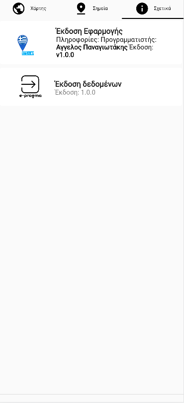
Info
This tool is an EGSA87/GGRS87 to WGS84 (world geodetic system) coordinate converter View and convert the GPS position to WGS84 coordinates and from there to the Greek Geodetic Reference System EGSA87 (GGRS87 - EGSA 87).
- See the points on a map
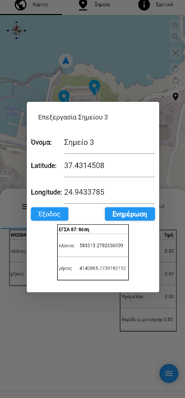
- Put data on the point such as name, description and attach photo.
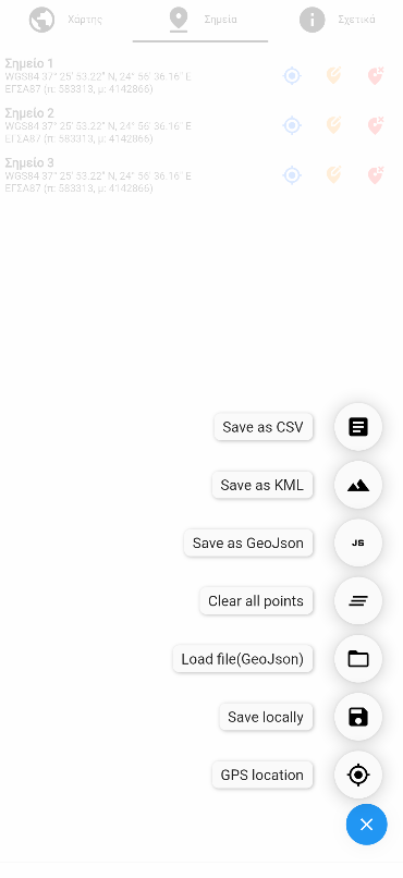
- Save the increased precision measurements to a list of points.
- Easy to copy coordinates
- Export your points to csv, kml kmz and GeoJson files.
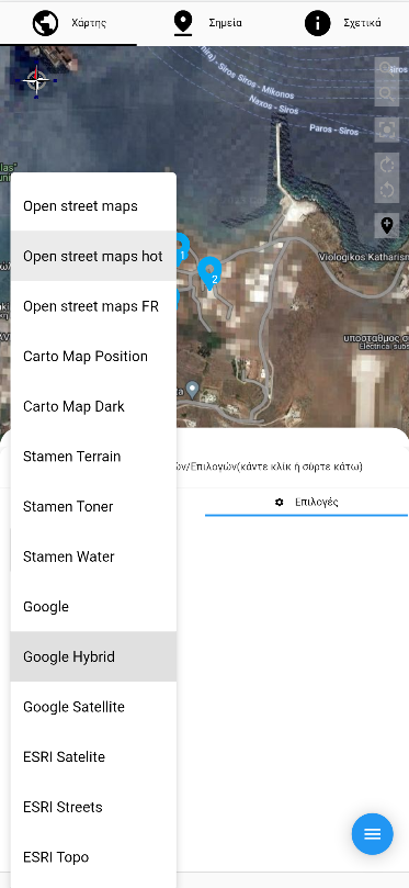
- Improved integration of view on maps with different backgrounds like open street maps, google maps, esri maps, etc.
Useful for Greek land registry / real estate registry /private ownership of urban land applications
EGSA Map Application User Guide
Main Features
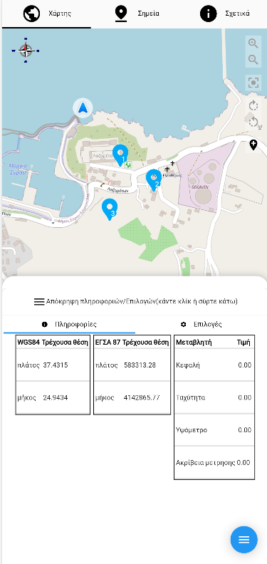
1. Interactive Map
- Multiple map types/layers available
- Zoom in/out controls
- Rotation controls (90° clockwise and counterclockwise)
- Compass indicator showing current map orientation
- Location tracking with GPS
2. Location Management
- View current GPS location
- Center map on current location
- Add custom points/markers on the map
- Drag and drop markers to new positions
- View all saved points
- Center map to show all markers
3. Coordinate Systems
- Real-time coordinate conversion between:
- WGS84 (GPS coordinates - Latitude/Longitude)
- EGSA87 (Greek Grid Reference System)
- Add points using either coordinate system
- Copy coordinates with a single click
4. Navigation Modes
- Free navigation mode
- Follow location mode (map centers on your position)
- Heading mode (map rotates with your movement)
5. Point Management
- Add points at current location
- Add points using coordinates
- Edit point information
- Delete points
- View point details
- Save points for future use
- Import/Export points
6. Information Display
- Current location coordinates (WGS84 & EGSA87)
- Location accuracy
- Altitude information (when available)
- Map zoom level
7. Settings
- Map type selection
- Navigation mode preferences
- Display options
Interface Layout
The app interface is divided into several key areas: 1. Top: Main navigation tabs 2. Center: Interactive map 3. Bottom: Sliding panel with location information and settings 4. Right side: Map controls (zoom, rotation, centering) 5. Left side: Compass indicator
Common Tasks
How to Add a New Point
- Click the "Add Point" button
- Choose one of the following methods:
- Use current location
- Enter WGS84 coordinates
- Enter EGSA87 coordinates
How to Convert Coordinates
- Go to the conversion tab
- Enter coordinates in either WGS84 or EGSA87 format
- View the converted coordinates
- Optional: Click to copy the converted values
How to Center on Current Location
- Click the GPS icon in the map controls
How to View All Points
- Click the "Center All" button to zoom the map to show all saved points
Tips
- Use the sliding panel at the bottom to access detailed information and settings
- Long-press on coordinates to copy them
- The compass helps maintain orientation when the map is rotated
- Save your points regularly to prevent data loss
hide: - navigation - toc robots: noindex, nofollow sitemap_exlude: "yes" search: exclude: true
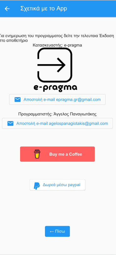
Like this app? Donate
This app needs donations to move forward